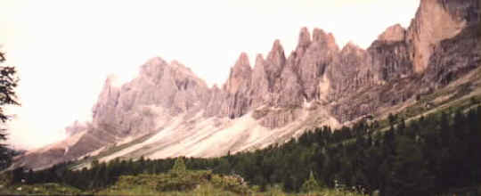
Geisler Group
|
 The territory of Trentino-Alto Adige
formed part of the Austrian Tirol until the end of World War I, when it
was ceded to Italy. From 1919 to 1947 the area was known as Venezia
Tridentina. In 1948 Trentino-Alto Adige was established as an autonomous
region. German-speaking inhabitants residing mainly in the Alto Adige
district form a significant proportion of the population. In 1970, after
local elections which were regarded as realistically representative, a
relative peace was established between the German- and Italian-speaking
populations of Bolzano and Trento.
The territory of Trentino-Alto Adige
formed part of the Austrian Tirol until the end of World War I, when it
was ceded to Italy. From 1919 to 1947 the area was known as Venezia
Tridentina. In 1948 Trentino-Alto Adige was established as an autonomous
region. German-speaking inhabitants residing mainly in the Alto Adige
district form a significant proportion of the population. In 1970, after
local elections which were regarded as realistically representative, a
relative peace was established between the German- and Italian-speaking
populations of Bolzano and Trento.
Dolomites or Dolomite Alps, mountain range in northern Italy, a
subdivision of the Eastern Alps, and part of the South Tirolese Alps,
located east of the Adige River. Some peaks are formed of dolomite and
marked with unusual colours. The Dolomites reach their greatest height in
Mount Marmolada, 3,342 m (10,965 ft) above sea level, and there are 18
other peaks over 3,050 m (10,000 ft). There are also 41 glaciers in the
range. Many of the sharp peaks of the range were first ascended in the
latter parts of the 19th century by British mountain climbers.
Microsoft(R) Encarta(R) 96
Encyclopedia. (c) 1993-1995 Microsoft Corporation. All rights reserved.
(c) Funk & Wagnalls Corporation. All rights reserved.
|
|
Italian Alps |
|
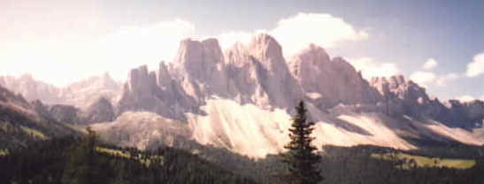
The peaks of the range have very beautiful
shapes than are best admired from every angle in an overnight trip around
the Geisler Group. |
|
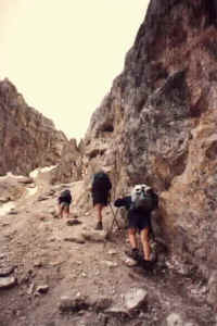
Head for Schlüterhütte on a grassy low pass, then
follow track 3 over Roa pass (the obvious dent at top of scree
below).
|
| The
last ascent is on a moderate scree slope, beautiful changing views of all
ranges in the area on the way down. A dry riverbed is crossed before
reaching Regenburgerhütte on a grassy hill on the
opposite bank. Very comfortable overnight stop with magnificent views of
the ranges' jagged peaks. |
 |
|
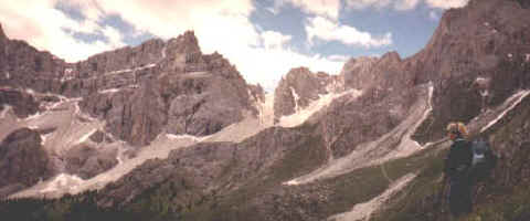
There are several options to get there and get back to
Zans, one of them is Mittagsscharte a high scree pass through towering
peaks (center of picture below).
Another one (tracks 2a, 3, 35) skirts the range at a
distance in meadows and forests to eventually follow the very foot of the
range. (Route 6 via Pana Scharte has been closed since 1997 due to a
landslide, check if re-opened.) |
| Start at Zans
in Villnöss |
|